 Quiet Roamers
Diese Seite gibt es noch nicht auf Deutsch; hier ist die englische Fassung.
Ort · Aktualisiert 24. Oktober 2026 · Von Gert Orasmäe und Siim Orasmäe
Kakerdaja bog
A raised bog in Kõrvemaa with a boardwalk across it, a lake in the middle and two RMK campfire sites at the edge. How to walk it, where to park, and what it looks like in October fog.
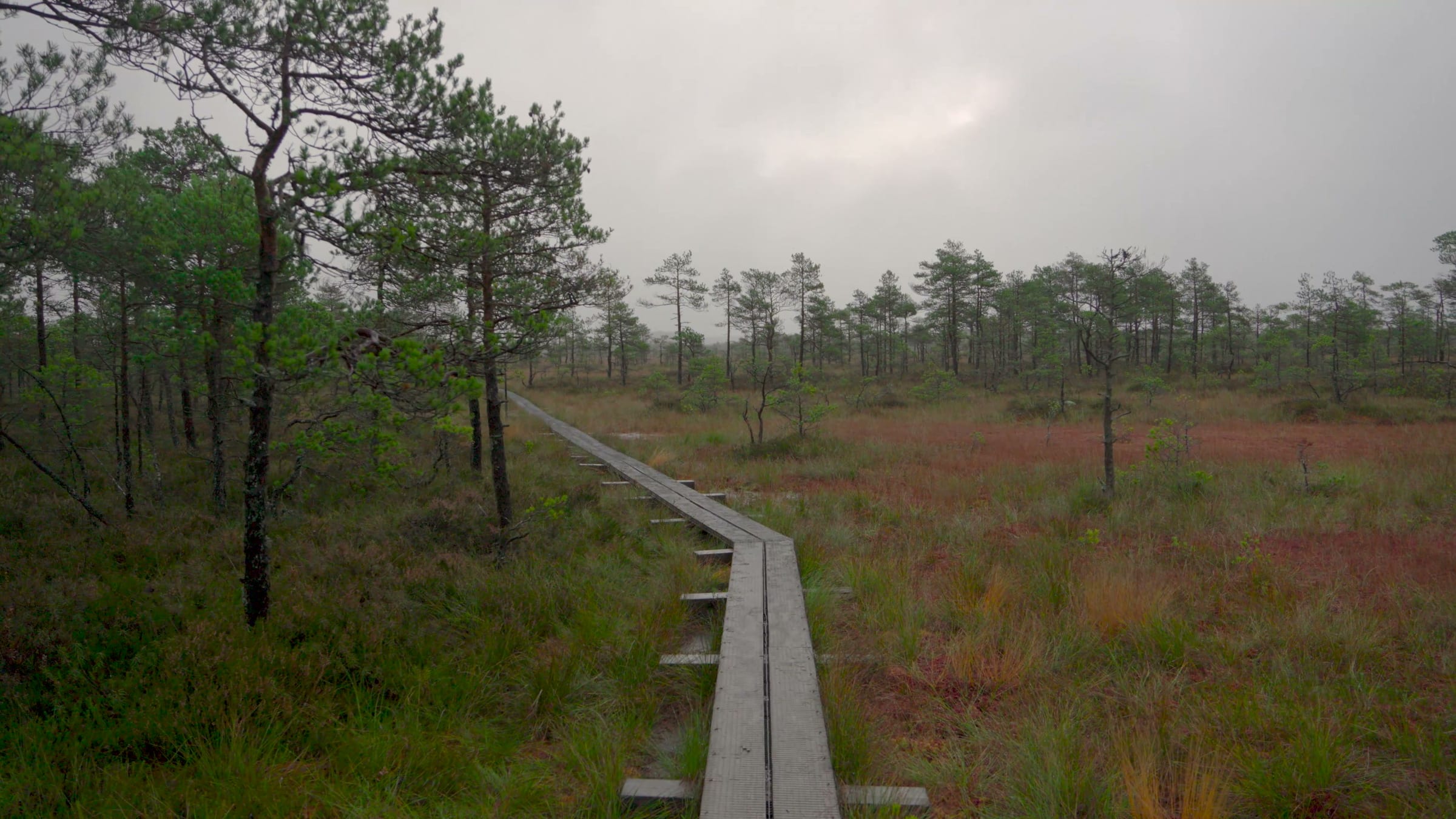
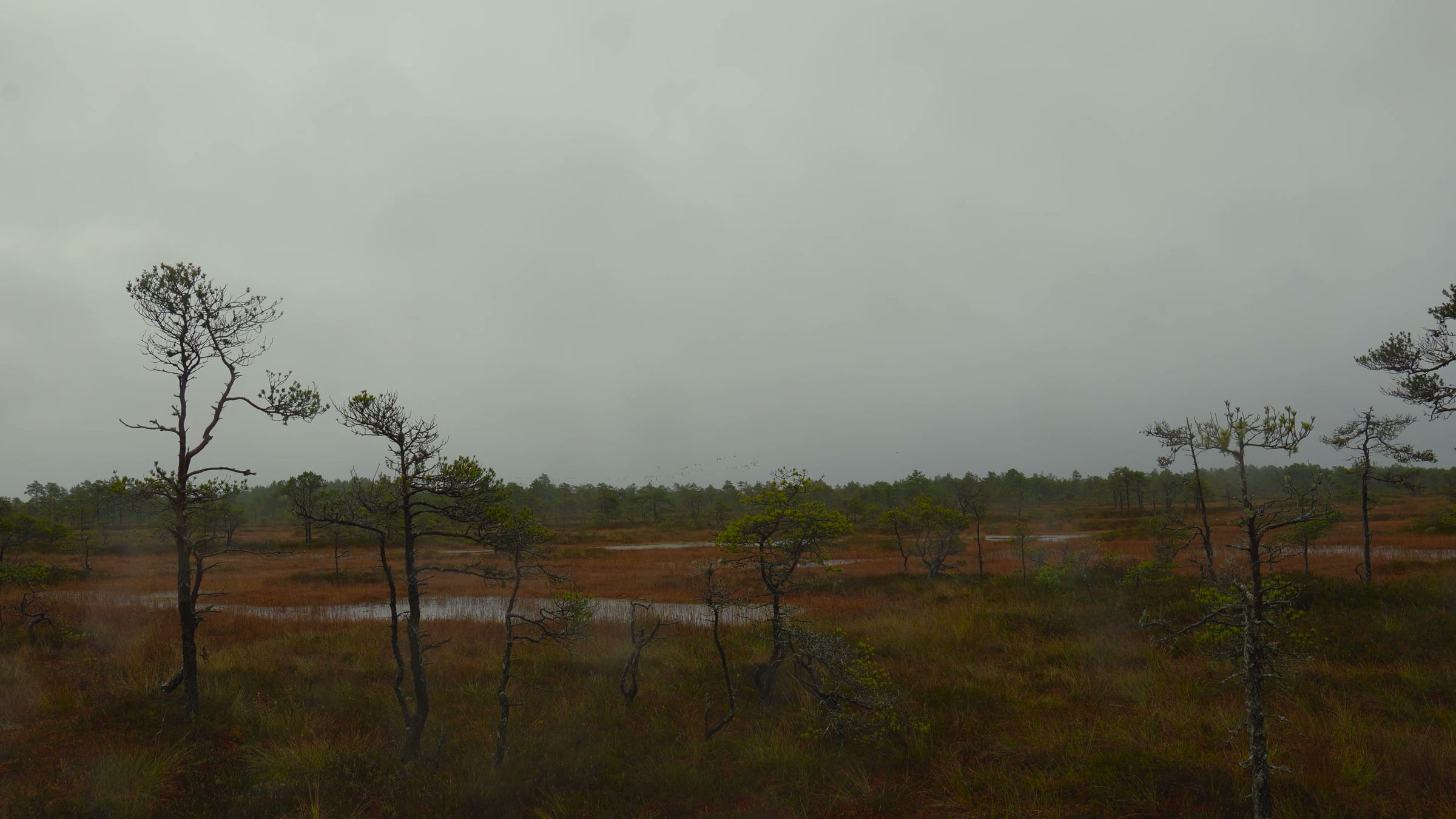
Kakerdaja is a raised bog in Kõrvemaa, on the border of Harju and Järva counties east of Tallinn. A boardwalk crosses it to Kakerdi lake (also called Kakerdaja lake) in the middle, past dozens of dark bog pools. We walked it on the morning of 10 October 2026 at the end of a two-day hike, in fog so thick that the lake only appeared at the last bench. The film starts at that moment above.
The trail
RMK runs the Kakerdaja nature trail (7 km) in the Aegviidu-Kõrvemaa recreation area. You can walk it two ways:
- Across the bog on the boardwalk, about 4 km, out to the lake and back or on through to the far side. The RMK pages for the long-distance trail put the boardwalk at "over 3.5 km".
- The Kalajärvede ring, a 3 km loop past Väike and Suur Kalajärv, two small lakes on the forest side of the bog.
There are 16 information boards along the way. The bog is part of the Epu-Kakerdi bog complex and has many bog pools ("laukad"); Kakerdi lake in the middle is about 6.6 hectares. Visit Estonia gives the whole bog as about 1,000 hectares, lying at two different heights.
Getting there
By car, take the Perila–Jäneda road (no. 11125). Coming from Vetla, turn right just before the 23 km post, follow the gravel road for 1.8 km and then 200 m to the Kalajärve parking area, where the trail starts. The other start is at Noku parking, 3.2 km further down the same gravel road.
On foot, Kakerdaja is on the Oandu–Aegviidu–Ikla trail: Noku campfire site is 19 km south of Aegviidu railway station, which is how we came. That walk is our Aegviidu – Napu hike, and the area around it is in the Kõrvemaa guide.
Parking
Both car parks are small, so on a fine weekend come early or be ready to walk in from the other one; they are 3.2 km apart along the gravel road. RMK's pages give slightly different counts, so read these as the order of size:
| Car park | Places | Coordinates | Start of |
|---|---|---|---|
| Kalajärve | 6–8 cars | 59.199511, 25.509672 | the Kalajärvede loop; the boardwalk is a short walk on |
| Noku | 10–12 cars or 2 buses | 59.188554, 25.509927 | the boardwalk, which leaves straight from the campfire site |
At Kalajärve the car park is fenced with logs and the dry toilet is next to it. Park inside the fence and leave the gravel road clear; it is the only access to the campfire sites.
How long it takes
From Noku to Kakerdi lake took us about two hours, slowed by the fog and the camera. Without stops, reckon on about an hour for the boardwalk out to the lake and back, and two to three hours for the whole 7 km trail with the Kalajärvede loop. Add time for wet boards: in rain everyone walks slower than they think.
Campfire sites
- Noku, at the start of the boardwalk, named after the old Nokko farm. Two fire sites with covered fire pits, three open lean-to shelters, covered tables, firewood shelters and dry toilets, and room for about ten tents. We slept here.
- Kalajärve, by Kalajärv on the ring trail. A covered fire pit with a grill, a covered table, a dry toilet and a firewood shelter, room for four tents; water from the lake for washing and cooking (treat it).
Both are free and shared with whoever arrives; there is no booking. How RMK sites work, and the others we have slept at, are in RMK campfire sites we have slept at.
In the fog
We left Noku at first light. On the boardwalk the fog closed in to the nearest pines, and every pool looked the same. The boards are narrow, in places a single plank wide, and they were slick after a night of rain: walk in boots, not trail runners, and take it slowly in rain or frost. The boardwalk ended at Kakerdi lake, and the crossing took us about two hours, slowed by the fog and the camera. The quiet is the point. Apart from the boards under your feet there is almost no sound.
In winter
RMK maintains the trail all year, and with snow on the pools the bog is at its most open. The boards are the slipperiest thing on the trail in frost, so bring spikes for your boots, and never step off the boardwalk onto a frozen pool: ice over bog water is not to be trusted. Local guides run snowshoe hikes (räätsamatk) across the bog in winter, listed by Visit Järva; we have not been on one. We plan to come back for a crossing of our own after the first proper snow.
Rules
- Stay on the boardwalk; the bog does not carry you.
- No cycling on the boardwalk: push your bike.
- Fire only in the fire pits at the campfire sites, and only when fire is allowed (check the fire risk at ilmateenistus.ee).
- Quiet hours at the campfire sites are 23:00–6:00, and dogs stay on a lead.
Quellen
Die praktischen Angaben auf dieser Seite stammen aus diesen Quellen; prüfe sie vor der Tour, Dinge ändern sich.
- RMK: Kakerdaja loodusrada (7 km)
- RMK: Kakerdaja nature trail (English)
- RMK: Noku lõkkekoht
- RMK: Kalajärve lõkkekoht
- RMK: Oandu–Aegviidu–Ikla matkatee, Aegviidu–Hirvelaane (61 km)
- RMK: looduses liikumise juhised
- Vikipeedia: Kakerdaja raba
- Vikipeedia: Kakerdi järv
- Visit Estonia: Kakerdaja bog hiking trail
- Visit Järva: räätsamatk Kakerdaja rabas